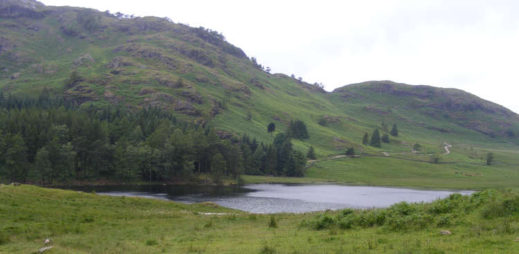
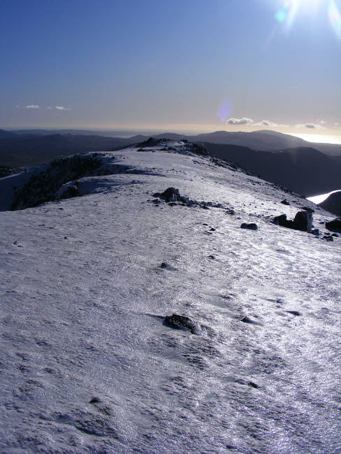
This is our sitemap, showing roughly how the site is arranged. Pages that are in more than one area will be show in their main area here.
- Home
- Areas of Beauty
- Photos
- Lakes
- Photo: Aira Force
- Photo: Derwentwater
- Photo: Skiddaw
- Photo: Thirlmere
- Photo: Lodore Falls 1
- Photo: Lodore Falls 2
- Photo: Pike Howe, Langdale Pikes
- Photo: Loft Crag
- Photo: Harrison Stickle
- Photo: View west from Harrison Stickle
- Photo: Sergeant Man and Codale Head
- Photo: The view from Sergeant Man
- Photo: Summit of Haystacks
- Photo: Innominate Tarn
- Photo: Pillar from Haystacks
- Photo: Great Gable from Haystacks
- Photo: The Buttermere Valley from above Warnscale Bottom
- Photo: Haystacks seen over Buttermere
- Photo: Buttermere
- Photo: Barf
- Photo: View from slopes of Seat How
- Photo: The Bishop
- Photo: Skiddaw
- Photo: Forest track in Whinlatter Forest
- Photo: Small Water and Haweswater
- Photo: Small Water
- Photo: Haweswater
- Photo: Shelters at Small Water
- Photo: Mardale Waters
- Photo: White Moss Common
- Photo: Rydal Water from White Moss Common
- Photo: Helm Crag
- Photo: Falls near White Moss Common
- Photo: Nab Scar on Heron Pike
- Photo: River Rothay between Rydal Water and Grasmere
- Photo: Rydal Woods
- Photo: Rydal Corpse Road
- Photo: Rydal Mount
- Photo: Grisedale Tarn
- Photo: Striding Edge from Nethermost Pike
- Photo: Helvellyn from High Crag
- Photo: Eagle Crag from Grisedale
- Photo: Grisedale
- Photo: Swirral Edge
- Photo: The view south from Helvellyn
- Photo: View west from Helvellyn
- Photo: Glenridding valley
- Photo: Helvellyn Lower Man
- Photo: Sheffield Pike from Helvellyn
- Photo: Glencoyne
- Photo: Glenridding from Above
- Photo: Bleabank Side
- Photo: Nick Head
- Photo: Black Crag on Sheffield Pike
- Photo: Heron Pike on Sheffield Pike
- Photo: Ullswater from Sheffield Pike
- Photo: Woods around Claife Heights
- Photo: Moss Eccles Tarn
- Photo: Woodland paths on Windermere
- Photo: Kentmere Hall
- Photo: Crag on Thornthwaite Crag
- Photo: Froswick and Thornthwaite Crag
- Photo: Longsleddale
- Photo: Kentmere Reservoir
- Photo: Garburn Pass
- Photo: Garburn Nick
- Photo: High Street from Harter Fell
- Photo: Harter Fell
- Photo: Ill Bell
- Photo: Windermere over Troutbeck
- Photo: Ullswater from Thornthwaite Crag
- Photo: Yewdale Fells
- Photo: Coniston Water
- Photo: Old Man of Coniston from the Gondola
- Photo: Figurehead of the Steam Yacht Gondola
- Photo: St Peter's Church, Far Sawrey
- Photo: Hill Top, Near Sawrey
- Photo: Top of Loughrigg
- Photo: Northern slopes of Loughrigg
- Photo: Loughrigg Terrace
- Photo: Grasmere from Loughrigg Terrace
- Photo: Goat's Water
- Photo: Brown Pike (Dow Crag)
- Photo: View north from the Old Man of Coniston
- Photo: Blind Tarn
- Photo: Harter Fell, Eskdale
- Photo: Dow Crag
- Photo: Summit of the Old Man of Coniston
- Photo: Goat Crag, Old Man of Coniston
- Photo: Birk Fell and Goat Crag
- Photo: Sandwick, Ullswater
- Photo: High Dodd, Ullswater
- Photo: Ullswater from Gowbarrow Fell
- Photo: Woods at Aira Force
- Photo: Ruined hunting lodge, Gowbarrow Fell
- Photo: Eastern Path, Gowbarrow Fell
- Photo: Lyulph's Tower
- Photo: Summit of Gowbarrow Fell
- Photo: Latterbarrow
- Photo: Windermere from Latterbarrow
- Photo: Hawkshead seen from Latterbarrow
- Photo: Moses Trod
- Photo: Styhead Tarn
- Photo: Somewhere on Scafell Pike
- Photo: Wasdale Head
- Photo: Ruddy Gill
- Photo: Castle Crag
- Photo: Spoil heaps on Castle Crag
- Photo: The quarry on Castle Crag
- Photo: The Derwent at Rosthwaite
- Photo: The War Memorial on Castle Crag
- Photo: Borrowdale from Castle Crag
- Photo: The Woods on Castle Crag
- Photo: Tarn Hows from Howgraves
- Photo: Langdale Pikes from Tarn Hows
- Photo: Lags Coppice, Tarn Hows
- Photo: Silver How from Dow Bank
- Photo: Summit of Pavey Ark
- Photo: Harrison Stickle from Pavey Ark
- Photo: Pike of Stickle from Harrison Combe
- Photo: Pavey Ark from Blea Rigg
- Photo: Huntingstile Crag
- Photo: Elterwater
- Photo: View south from Lang How
- Photo: Silver How to Sergeant Man
- Photo: View from Silver How
- Photo: Summit Cairn, Scafell Pike
- Photo: Cloud-capped Mickleden
- Photo: Allen Crags
- Photo: Rossett Pike from Esk Hause
- Photo: The end of Mickleden
- Photo: Rossett Gill in the Fog
- Photo: Fleetwith Pike over Buttermere
- Photo: Buttermere village from Old Burtness
- Photo: The final scramble up Red Pike
- Photo: Red Pike from Dodd
- Photo: Buttermere from Dodd
- Photo: Crummock Water from Dodd
- Photo: Crummock Water and Loweswater
- Photo: Red Pike from Bleaberry Tarn
- Photo: Grasmore from Bleaberry Tarn
- Photo: Ling Comb from Red Pike
- Photo: Scales Wood, Crummock Water
- Photo: Bleaberry Tarn
- Photo: Rock step on Whiteless Pike
- Photo: Whiteless Pike from Whiteless Breast
- Photo: Whiteless Edge from Whiteless Pike
- Photo: View south from Whiteless Pike
- Photo: High Rannerdale
- Photo: Whiteless Pike from Dale How
- Photo: Above Hause Point, Crummock Water
- Photo: Whiteless Breast
- Photo: Great Gable from Brandreth
- Photo: Great Round How, Brandreth
- Photo: Brandreth to Grey Knotts
- Photo: Ennerdale Forest Road
- Photo: The concrete bridge, Ennerdale
- Photo: Ennerdale Water from the south east
- Photo: Anglers' Crag from the east
- Photo: Ennerdale from Anglers' Crag
- Photo: Fleetwith Pike from Grey Knotts
- Photo: Haystacks from Fleetwith
- Photo: Northern shore of Buttermere
- Photo: Bowness from the lake
- Photo: Mountains seen over Windermere town
- Photo: Cockermouth
- River Liza from Haystacks
- The Source of the Ehen
- The Upper Ehen
- Kentmere Tarn
- Easedale Tarn from Sergeant Man
- Easedale Tarn from Blea Rigg
- Codale Tarn
- Stickle Tarn from above
- TARNS GALLERY
- Skelwith Force
- River Brathay at Skelwith Bridge
- Small Water combined
- Red Tarn from Helvellyn
- Blea Water from High Street
- Blackbeck Tarn, Haystacks
- Blea Tarn, the Langdales
- Low Water, Old Man of Coniston
- Watendlath Tarn 1 of 2
- Watendlath Tarn 2 of 2
- Greenburn
- Old Man of Coniston from Dow Crag
- Bridge over Greenburn Beck
- Low Hall Garth
- Wet Side Edge
- North East from Swirl How
- Nanny Lane, Troutbeck
- The Hundreds, Wansfell
- View west from Wansfell
- The view along Wansfell
- Hundreds Road, Wansfell
- Newlands School
- Scope End
- Hindscarth from Scope End
- Dale Head Tarn
- High Spy Crags
- Windermere from Loughrigg Fell
- The Langdale Pikes seen over Elter Water
- Redbank Wood
- Loughrigg Tarn
- Newlands School
- Scope End
- Hindscarth from Scope End
- Newlands Valley from Hindscarth
- Dale Head Tarn
- Crays of High Spy
- River Brathay at Little Langdale
- Workings on Moss Rigg Wood
- Herdwick Sheep in Tilberthwaite
- Little Langdale from Knotts
- Little Langdale from Lingmoor Fell
- Summit cairn on Lingmoor Fell
- View east along Lingmoor Fell
- View west along Lingmoor Fell
- Summit of Lingmoor Fell
- The Langdale Pikes from Lingmoor Fell
- Crag Fell from the West
- Ennerdale from Crag Fell
- The western slopes of Crag Fell
- The Ben Gill Ravine, Crag Fell
- View east from Crag Fell
- Foggy day on Harter Fell, Esk Dale
- Jubilee Bridge, Hardknott Gill
- Esk Dale at Brotherilkeld
- Approaching Hardknott Fort from the pass
- North flank of Harter Fell
- Bottom half of Lad Hows
- Top half of Lad Hows
- Rannerdale Beck
- Summit of Grasmoor
- Liza Beck, Gasgale
- Gasgale Crags
- Crag Hill
- Coledale
- Coledale Hause
- Dove Crags, Grasmoor
- Haystacks and Great Gable
- Rannerdale Knotts
- Monks Bridge
- Swarth Fell
- Upper Calder Valley
- Calder at Buck Hole
- Valley of Whoap Beck
- Summit of Lank Rigg
- The Calder at Latter Barrow
- Grasmoor seen from Lank Rigg
- Caw Fell seen from Lank Rigg
- Cogra Moss and Blake Fell
- Cogra Moss
- Low Pen, Lamplugh Fell
- Knock Murton and Cogra Moss
- Summit of Blake Fell
- Great Borne over Croasdale Beck
- Buttermere from Blake Fell
- Photo: West face of Scafell
- Photo: Illgill Head from Scafell
- Photo: Symonds Knott from the south
- Photo: Western slopes of Scafell
- Photo: Scafell Pike from Scafell
- Photo: Mickledore from Scafell
- Photo: View north from Scafell
- Photo: Illgill Head from Brackenclose
- Photo: Burnmoor Tarn from the north
- Photo: Waterfall on Oliver Gill
- Photo: Long Green, Scafell
- Photo: Slight Side from the north
- Photo: Crinkle Crags from Scafell Pike
- Photo: Burnmoor Tarn from Bleaberry How
- Photo: Quagrigg Moss
- Photo: Loweswater from Lad Hows
- Photo: Loweswater from the south
- Photo: Stanley Force
- Photo: Scoat Tarn
- Photo: Keswick from Thornthwaite Forest
- Photo: Summit ridge, Whinlatter Top
- Photo: Kirk Fell and Graystones
- Photo: Whinlatter Pass from the slopes above the road
- Photo: Pillar seen along Mosedale
- Photo: Black Comb, Mosedale
- Photo: The exit from Mosedale
- Photo: The path from Wind Gap to Pillar
- Photo: Crags below the summit of Pillar
- Photo: Ennerdale from Pillar
- Photo: Steep from Scoat Fell
- Photo: Great Gable from Wasdale Head
- Photo: West slope of Great Gable
- Photo: Wasdale from Gable Beck
- Photo: Ennerdale from above Beck Head
- Photo: View from Great Gable towards Borrowdale
- Photo: Summit of Great Gable
- Photo: View south-east from Great Gable
- Photo: Gable Crag
- Photo: Westmorland Cairn, Great Gable
- Photo: Styhead Tarn from Great Gable
- Photo: Upper Wasdale
- Photo: Highnook, Loweswater
- Photo: Grasmoor seen across Loweswater
- Photo: Terrace on Burnbank Fell
- Photo: Path between Loweswater and Hudson Place
- Photo: Coppermine Valley
- Photo: Swirl How over Levers Water
- Photo: The summit of Wetherlam
- Photo: Hole Rake, Coniston Fells
- Photo: View east from Wetherlam
- Photo: Coniston Water seen from Wetherlam
- Photo: Gosforth from the North
- Photo: Wasdale from Bleng Fell
- Photo: River Bleng
- Photo: Gate in Blengdale
- Photo: Scafell Range in the Snow
- Photo: Needle Ice
- Photo: Needle Ice 2
- Photo: Needle Ice 3
- Photo: Needle Ice 4
- Photo: Icicle on Brimfull Beck
- Photo: Icicle on Brimfull Beck
- Photo: Semi-frozen Brimfull Beck
- Photo: Helvellyn distant view
- Photo: View north-east from Wasdale Red Pike
- Photo: Snow-covered summit of Scafell Pike
- Photo: The West Face of Great Gable
- Photo: Frozen Low Tarn
- Photo: A Wintry Wasdale Red Pike
- Photo: Cornice on Wasdale Red Pike
- Photo: Towards the summit ridge of Red Pike
- Photo: Wasdale Head from Red Pike
- Photo: Lone Wanderer on Red Pike
- Photo: Snow field on Red Pike
- Photo: A frozen Derwent Water
- Photo: Keswick Piers frozen
- Photo: Bassenthwaite frozen over
- Photo: Dodd seen across Bassenthwaite
- Photo: Red Pike over Over Beck
- Photo: Over Beck
- Photo: Dropping Crag and Bell Rib
- Photo: Middle Fell over Nether Beck
- Photo: Scale Force
- Photo: A snowy Buttermere Red Pike
- Photo: Crummock Water from Scales
- Photo: Dodd from Red Pike
- Photo: Skelgill Bank on Cat Bells
- Photo: The Cat Bells Ridge
- Newlands Valley from Cat Bells
- Maiden Moor from High Spy
- Cat Bells from Maiden Moor
- The Sources of Newlands Beck
- Works at Rigghead Quarries
- Gowder Dub, River Derwent
- Derwent Water across Brandelhow Bay
- The path to Brackenthwaite Hows from Lanthwaite Wood
- The summit of Brackenthwaite Hows
- Buttermere Fells from Brackenthwaite Hows
- Lingcove Bridge
- Waterfall on Lingcove Beck
- River Esk under Heron Crag
- Rocky Step on the Corridor Route
- Lingmell and Piers Gill
- Top of Piers Gill
- Broad Col from the Corridor Route
- Sty Head from the Corridor Route
- The Corridor Route Tarn
- Great End over Round How
- Summit of Scafell Pike
- Wasdale Head from Lingmell
- Wasdale from Irton Pike
- Latterbarrow (Wasdale) from Irton Pike
- Irton Pike Path
- Tarn Hows in Winter
- Tom Gill Falls
- Hatteringill Head
- Skiddaw from the Loweswater Fells
- Loweswater village seen from above
- Hopegill Head from the Loweswater Fells
- Darling Fell from Low Fell
- Loweswater from Waterend
- The Northern Loweswater Fells
- Loweswater from Low Fell
- The Centre of the Loweswater Fells
- Carling Knott over Loweswater
- The Band from Great Langdale
- Great Langdale seen from The Band
- Crinkle Crags from the Band
- Great Slab, Bow Fell
- Scafell Range from Three Tarns
- Entrance to Burtness Comb
- North Face of High Crag
- High Crag from High Stile
- The view down Burtness Comb
- High Stile from the West
- Close-up view of Scale Force
- Ennerdale from Red Pike
- The Floor of Burtness Comb
- View north from High Stile
- Caldbeck
- Hesket Newmarket
- The Duddon Valley from Froth Pot
- Harter Fell from the Duddon Valley
- West ridge of Grey Friar
- Langdale Pikes from Great Carrs
- The Old Man of Coniston from Brim Fell
- Seathwaite Tarn seen from Swirl Band
- Summit Cairn on Brim Fell
- Tourist Route up the Old Man of Coniston
- Brim Fell from the West
- Seathwaite Tarn Dam
- Seathwaite Tarn from the Dam
- First Sight of Red Pike
- Final Climb up Red Pike
- Top of Sourmilk Gill
- Summit of High Stile
- The Red Pike to High Stile Ridge
- Gamlin End
- Above Gamlin End
- Big Stack, Haystacks
- Wall Castle
- Dunes at Ravenglass
- Newtown Knott
- Ravenglass Foreshore
- Country Lane at Walls, near Ravenglass
- Esk Estuary Path
- Ravenglass across the Esk
- View north from Gummers How
- View South from Gummers How
- Helm Crag from Gibson Knott
- The Howitzer, Helm Crag
- Far Easedale from Helm Crag
- Gibson Knott and Calf Crag
- Falls on Far Easedale Beck
- Helm Crag from Brownrigg Moss
- Lower Easedale
- Helm Crag from Grasmere
- Beacon Tarn
- Old Man of Coniston seen from the south
- Lane in the Blawith Fells
- Morecombe Bay from Beacon Fell
- View north from Beacon Fell
- Summit of Beacon Fell
- Mid Miterdale
- Miterdale Head
- View down Miterdale
- Yewbarrow from Illgill Head
- Illgill Head to Whin Rigg
- Wasdale Head from Illgill Head
- Above the Screes
- Tongues Gills
- Valley of Nether Beck from head of Greendale Beck
- Greendale Tarn
- Summit of Middle Fell
- Wast Water Screes
- Low Ling Crag, Crummock Water
- The Mosedale Holly Tree
- West Shore of Crummock Water
- Southern end of Mellbreak
- Kirkstile Inn
- Summit of Bleaberry Fell
- Helvellyn Range from Bleaberry Fell
- Keswick from Lady's Rake
- Walla Crag through Great Wood
- Bow Fell from Esk Dale
- Scafell from the Upper Esk
- Blea Tarn, Esk Dale
- Hollinghead Bank
- Mine Buildings, Boot Bank (Esk Dale)
- Grasmoor from Gavel Fell
- North ridge of Gavel Fell
- High Stile range from Gavel Fell
- Crystal Clear Pool in the River Esk
- Swinsty Gill, Crinkle Crags
- Adam-a-Cove, Crinkle Crags
- Bow Fell from Crinkle Crags
- View along Crinkle Crags
- Tarn on Summit of Crinkle Crags
- Whiteside End
- Mouth of Gasgale Gill
- Rocks of Gasgale Crags
- Whiteside Ridge looking east
- Whiteside Ridge looking west
- Hopegill Head over Gasgale
- Loweswater from Whiteside
- Esk Pike from Esk Hause
- Bow Fell from Esk Pike
- Eskdale from Three Tarns
- Corridor Route from Lingmell
- Greathall Gill
- Illgill Head from Whin Rigg
- Wasdale Head from Mecklin Park
- Wast Water from Whin Rigg
- River Irt at Low Wood
- Top of Doddick Fell
- Side view of Sharp Edge
- Scales Tarn from Above
- View down Doddick Fell
- Valley of Scaley Beck, Blencathra
- Sharp Edge from Tarn Crags
- Summit of Blencathra from Doddick Fell
- Sharp Edge seen from Above
- Skiddaw seen from Blencathra
- Gategill Fell Top, Blencathra
- View south-west from Blencathra
- View of Blencathra from Scales Fell
- View west from Blencathra
- Southern Ridges of Blencathra
- North-east Ridge of Grisedale Pike
- Grisedale Pike from Sleet How
- Force Crag from Sleet How
- The top of Sleet How, Grisedale Pike
- Rossett Pike from Langdale
- Angle Tarn and Rossett Pike
- Pike o' Stickle from Rossett Gill
- North-east Ridge of Scafell Pike
- False Esk Hause
- Calf Cove from Above
- Ill Crag and Scafell Pike
- Buckbarrow Sheepfold
- Buckbarrow from Below
- Gill Beck on Buckbarrow
- Tosh Tarn
- Buckbarrow Crags from Behind
- Crags of Buckbarrow
- Seatallan and Cat Bields
- Below Buckbarrow
- Tongues Gills from Above
- Summit Cairn, Seatallan
- Red Pike from Seatallan
- Middle Fell from Seatallan
- Langstrath Country Inn, Stonethwaite
- Smithymire Island
- Stonethwaite Beck
- A Misty Borrowdale
- Lower Langstrath
- Eagle Crag, Langstrath
- View from Barf
- Lord's Seat from Barf
- Heather covered Barf
- Rear view of Barf
- Eskdale Green from Hollowstones
- Muncaster Fell from Silver Knott
- Track on Silver Knott
- Eskdale from Silver Knott
- Track in Great Wood, Keswick
- The Path along the top of Walla Crag
- View from Walla Crag
- View from Cat Gill
- Knott Rigg
- Snockrigg Path
- Robinson from Snockrigg
- High Stile in the Snow
- Littledale Edge
- Loop in the River Bleng
- River Bleng in the trees
- Trees in Blengdale Forest
- Eskdale from the Scafell Terrace
- Terrace Route, Scafell
- Scafell from Cat Crag
- Wythop Old Church
- Sale Fell
- Ling Fell
- Wythop Valley
- Bassenthwaite from Sale
- Sale from Lothwaite
- The Road to Honister Quarry
- The Summit Plateau of Haystacks
- High Crag from Dubs Quarry
- First Glimpses of Haystacks from Honister
- Path above Green Crag, Haystacks
- Derwent Water from King's How
- Castle Crag from King's How
- Eelstep Brow
- Borrowdale from King's How
- Trees on Derwent Water
- Derwent Water shoreline path
- Derwent Water Ledge
- Southern part of Derwent Water
- Barrow Gill
- Force Crag
- The north-east ridge of Barrow
- Lower Newlands valley from Barrow
- Causey Pike from Barrow
- Outerside from Barrow
- Skiddaw from Barrow Door
- Braithwaite from Barrow
- Bridge Lane Troutbeck
- Town End, Troutbeck
- Windermere from Robin Lane, Troutbeck
- Wansfell from Hundreds Road
- Froswick from Troutbeck
- Robin Lane, Troutbeck
- North-east corner of Latterbarrow
- Lilly Pond
- Latterbarrow Monument
- Ambleside from Latterbarrow
- Spring Wood, Hawkshead
- View north from Latterbarrow
- Woods south-east of Latterbarrow
- Boredale Hause from Patterdale
- Patterdale from Boredale Hause
- Place Fell from Boredale Hause
- The view down Boredale
- Red Deer in Boredale (1 of 2)
- Red Deer in Boredale (2 of 2)
- Crags of Birk Fell, Ullswater
- Scalehow Force
- Below Silver Crag, Ullswater
- Ullswater glistening in the evening sun
- Sheep in Boredale
- View up Boredale
- Stickle Pike from South
- Stickle Pike seen from the West
- View south from Stickle Pike
- Summit Ridge of Stickle Pike
- Stickle Tarn from Stickle Pike
- The summit of Stickle Pike
- The View north from Stickle Pike
- Pillar from Kirk Fell
- Kirk Fell from the South
- Valley of Gable Beck
- Rib End, Kirk Fell
- Looking Down the Rib End Path
- Baysoar Slack, Kirk Fell
- The summit plateau, Kirk Fell
- Haystacks from Kirk Fell
- Scafell Range over Kirkfell Tarn
- Summit of Kirk Fell
- Kirkfell Crags
- Scoat Fell Cairn
- Scoat Fell from Red Pike
- Bowness Knott
- Bowness Knott from Crag Fell
- Ennerdale from Bowness Knott
- Stepping Stones in the Duddon
- Eastern End of Hardknott Pass
- Duddon Valley from the North
- Farmery, Ponsonby Fell
- Scalderskew Farm
- Worm Gill seen from Scalderskew
- View towards the Calder
- Wasdale Screes from Ponsonby Fell
- Summit of Brund Fell
- King's How from Brund Fell
- View north from Brund Fell
- Borrowdale from Brund Fell
- Summit of Grey Friar
- Grey Friar from the east
- Scafell Range from Grey Friar
- Path to Great Door
- Tarn on the summit ridge, Yewbarrow
- South Summit, Yewbarrow
- Above Great Door, Yewbarrow
- Looking down Stirrup Crag, Yewbarrow
- Start of middle path, Yewbarrow
- Western Slopes of Yewbarrow
- Red Pike and Pillar from Yewbarrow
- View north from Flat Fell
- Flatfell Screes from above
- Raven Crag, Nannycatch Gate
- Flatfell Screes from below
- Toward Nannycatch Gate
- Nannycatch Valley
- Hard Knott from the Fort
- Moasdale from the Top
- Border End, Hard Knott Fell
- Summit of Hardknot Pass
- Hardknott Fort from Border End
- Scafell Range from Hard Knott Fell
- The Eskdale Needle, Hard Knott Fell
- Lower Eskdale from Border End
- Upper Eskdale from Border End
- Tarn on Border End, Hard Knott
- Hard Knott from Border End
- Summit of Hard Knott
- Bold Sheep on Hard Knott
- Moss Dub
- Three Tarns from Bow Fell
- Tarn south of Three Tarns
- Sprinkling Tarn from Great End
- West across Yew Tree Tarn
- North across Yew Tree Tarn
- Dry Tarn
- High Nook Tarn from Blake Fell
- High Nook Tarn from Low down
- High Nook Tarn from Carling Knott
- Great How over Eel Tarn
- View north from Eel Tarn
- Over Water
- Siney Tarn
- Blind Tarn, Eskdale
- Stony Tarn from Scafell
- Angle Tarn from Above
- Angle Tarn from Rossett Gill
- Arnsbarrow Tarn from Top o' Selside
- Broadcrag Tarn close up
- Broadcrag Tarn (bottom middle)
- Broadcrag Tarn (bottom right)
- Great Carrs from Little Carrs
- Great Carrs from Swirl How
- Summit of Graystones
- Summit of Broom Fell
- Looking south down Graystones
- Darling How, Whinlatter fell
- Broom Fell from Lord's Seat
- Lorton from Graystones
- Looking west along Broom Fell
- Wythop Valley from Lord's Seat
- Aiken Valley from Lord's Seat
- Aiken Valley
- Wrengill Quarry
- Mosedale Cottage Bothy
- Longsleddale Quarry Road
- Tarn Crag Surveying Pillar
- Great Howe Longsleddale
- Ruin at mouth of Greycrag Tarn
- Sadgill Bridge
- Tarn Crag from Great Howe
- Resting Sheep, Great Howe
- Sadgill
- Lower Longsleddale
- View east from Tarn Crag
- Longsleddale Head
- Kemp Tarn from Reston Scar
- Reston Scar from the North
