FFF
Ascent: 170ft
Length:
6.5 miles
Map: Explorer 315 Carlisle
Last Walked:
fff
1: NY 394 567
At the end of Stage Two we had just crossed a bridge over the River Caldew at the western edge of Carlisle. We are now at the edge of a park between Carlisle Castle and the River Eden. This area floods on a regular basis, and so the main paths across the park are on raised banks. We need the left hand bank, which follows the line of the river. We follow this path across the northern edge of the sports field, until we reach a crossroads just past some tennis courts where we take the left hand path, still following the line of the river.
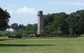
Follow this path as it runs under a main road, and reaches the second of our waypoints, a sport-centre NAME. Continue on past the sports centre, always following the river-side path for the next mile until we reach a memorial footbridge over the river.
2: NY 411 564
Cross over the footbridge. This brings us to Rickerby Park. A series of paths fan away from the bridge, with the main path leading directly to the war memorial. We need the next path to the right, which we follow until it reaches the road at the northern edge of the park.
3: NY 410 570
Turn right onto this road and follow it through the hamlet of Rickerby and on to the M 6 and Linstock.
4: NY 423 580
Our road crosses over the M 6 on a large bridge and then enters Linstock. This village has two main streets - our road which runs around the left of the village and a second one which runs to the right and passes through the larger part of the village. We need the right hand path, which we follow as it winds its way throught the village.
5: NY 427 583
At the far end of the village the road turns sharply to the left. Here we leave the road and continue on to the east along a farm track. Just outside the village this track turns right, and then left, passes a large farm, and then splits in two - take the left hand branch.
6: NY 433 588
Just after the branch, we reach a t-junction. Left leads to the hamlet of Park Broom, while right leads down to the River Eden. Take the right hand turn. When the track reaches the river bank, turn left onto a footpath that follows the river upstream. This path follows the line of the river as it curves around to the right. At the end of the curve the path vears a little away from the river, and follows a track across the next field, but only to cross over a small stream. On the far side of the stream turn right and head back to the river bank.
7: NY 446 594
At the end of the field after the small stream we reach the edge of Crosby-on-Eden, a rather scattered village. Leave the river bank and follow the small side road that leads into the village. After a short distance this side road joins the main road through the village. Turn right and follow this road for half a mile.
8: NY 454 597
After running between open fields, we begin to approach a cluster of trees. Just before we reach them (and a road junction), turn left onto a footpath. This path cuts across the corner of a field and then joins a farm lane. Follow this lane north as it crosses over the A 689.
On the far side of the bridge, turn right onto a track that runs along the edge of some trees parallel to the main road. After about 800 feet this track joins another track at a T-junction. Turn left and follow this track north for half a mile.
9: NY 453 608
After half a mile our track joins a minor road at a T-junction. Turn right onto this road. After just over half a mile the road turns off to the right - at this point we leave the road and follow a path that continues on to the east. We are now beginiing to reach the first real signs of the wall itself, which here manifest as a very straigh path. Follow this path past Bleatarn and on to Oldwall. Here the path crosses a minor road and then contines on to the right of the farm buildings, still in the same direction.
