 This is a walk of two halves, starting with a higher level section on Gag Lane, before dropping down to join the Tissington Trail. This is a very popular walk on the course of an old railway, so as well as offering different types of views, the second half of the walk will normally be much busier than the first.
Ascent: 800ft
Length: 6.75 miles
Map:  OL 24 White Peak Area
Last Walked: 30 December 2012
We start from a car park just to the east of Thorpe village. If coming from Ashbourne take the Thorpe and Dovedale turn. This brings us to a crossroads, with a pub at the left. Turn right there to reach the car park.
1: SK 164 504
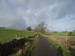
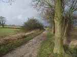
Turn right out of the car park. This brings us to a crossroads. Turn right onto Gag Lane, the smallest of the four roads, and signposted as a gated road. We are going to follow Gag Lane for its entire length, making one brief diversion towards the northern end.
2: SK 156 539
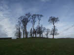
Our diversion takes us to Moat Low, a prehistoric site and great viewpoint. This diversion is two miles along the lane. We start with a steady climb, then head along a more level section, where the lane runs along the line of the hill, with higher ground to the left and slopes down to the right. The
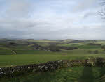
path to Moat Low comes towards the end of this section. The road begins to climb again just as it passes a farm. Look for a stile that crosses the wall just past the farm gates. This takes us into a small field - head diagonally across to the right to another stone stile. This takes us into a larger field, with Moat Low in the far corner. Head up to this super viewpoint, then return to the road and turn left to continue on in our current direction.
3: SK 158 544
Once we are back on the lane we turn left and head down towards the main road. From the road the Tissington Trail is visible, running along an embankment, and passing over a bridge for farm access. Cross the road and then head along a footpath that leads to the bridge. On the far side of the bridge a flight of stairs leads up to the Tissington Trail. At the top of the steps turn left onto the trail.
4: SK 178 521
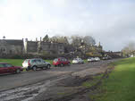
We follow the Tissington Trail all the way to Tissington village. The trail starts by curving to the left, and curves back to the right and runs around the village. Eventually we reach a car park built across the railway. A road leads out of the car park into Tissington village - explore this very attractive village then return to the railway and continue on in the same direction.
5: SK 166 503
We follow the railway almost all the way back to the car park. About half way there we cross a bridge over the main road. Eventually we reach another car park, this time next to the railway on the site of an old station. Turn right onto a lane that runs up from the railway. This brings us up to a bend in a minor road - head straight ahead here to return to the car park, which is in the bend of the road.
